RTK GNSS for your Smartphone
- External L1/L2 GNSS antenna
- Easy to use
- Centimetre accuracy for your Android phone
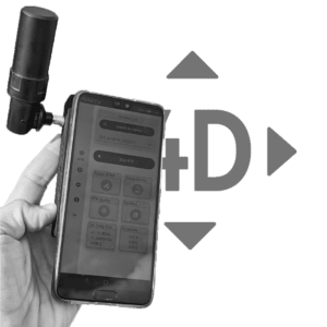
What is SmartphoneRTK ?
It is a Centimetre accurate, external GNSS antenna for your Android Smartphones or tablet.
The technology is based on a multiband GPS, GLONASS, Beidou, Galileo receiver in combination with a RTK correction data received via internet from your local NTRIP provider. An App allows you to connect to this casters via internet and receive correction data. This data enable the GNSS antenna to calculate your exact geolocation coordinates.
Whether for photogrammetry, documentation, or surveying, our Bluetooth external RTK L1/L2 GNSS antenna is a versatile tool that enhances the accuracy and reliability of location-based data. These coordinates are then available across a multitude of Apps such as the REDcatch RTKcamera App, SW-Maps, GNSS Master and can even be streamed directly into your Android system for broader use.
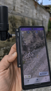
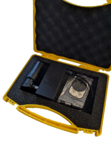
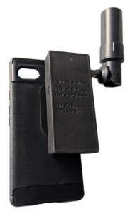
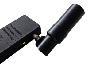
What you need to get started
Get yourself the latest GNSS technology to enhance your daily work. The add-on device comes with a modern Bluetooth board to ensure seamless connectivity and an onboard battery ensures uninterrupted field work for extended periods. However, it is important to note that merely having the latest gadgets is not enough. Proper training is needed to ensure the best usage of the technology, and to maximize your return on investment (ROI). Advanced GNSS mobile phone technology coupled with comprehensive training will not just equip you with the latest tools, but also enable you to work smarter and achieve better results.

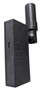
Lightweight RTK add-on for Android phones with tiltable antenna for best GNSS receiption.
RTK add-on for Android phone
- RTK L1/L2/e5 GNSS add-on
- integrated batteries (no cables required!)
- tilt-able Helical Antenna
- modern Bluetooth board
Technical Specifications
GNSS
- GPS, GLONASS, Beidou, Galileo
- Multiband: L1, L2, E5b
- Channels: up to 184
- ublox ZED F9P chipset
Accuracy
- RTK 0.01 m + 1 ppm CEP
- anti-jamming and anti-spoofing
- Depends on atmosphere, baseline length, satellite visibility, etc.
- RTK requires a subscription at local provider or own Ntrip caster
Connections
- USB (for charging only)
- Bluetooth (data connection to Smarphone)
Environment
- Temperature -5°C to +45 °C
- Please protect it from moisture and wetness
Wondering what you can do with Smartphone RTK?
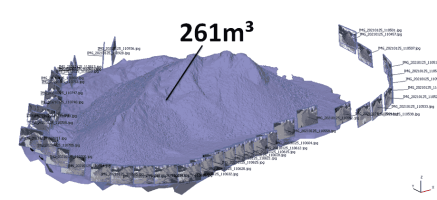
Easily record precise coordinates and write them directly into JPG/EXIF. Used for 3D PHOTOGRAMMETRY
Need additional information?
Ask a question
Not find your answer yet or like to talk to us? Write us a message
Seek for distributors
Contact a distributor in your area
Compatible Apps
Photo App
RTKcamera
The only “real” NTRIP + Camera App which takes full resolution images geotagged images at incredible speed.
Manual trigger, time laps and Overlap-Tie-Shoot (beta) is possible.
Visit on Google Playstore: RTK camera – Apps on Google Play
Mock Location App
Android allow to “Mock” a Location. With this Apps you can modify the GPS location, for example by using the one from external antenna. The problem is, that “Developer Mode” has to be activated and the update rate is 1Hz only. But if you can live with this restrictions, you can use the RTK positions Android wide.
Survey and GIS mobile Apps
Various Apps are available. However, we recommend SW Maps as it is free, easy to use and great for surveying and stake out points.


