
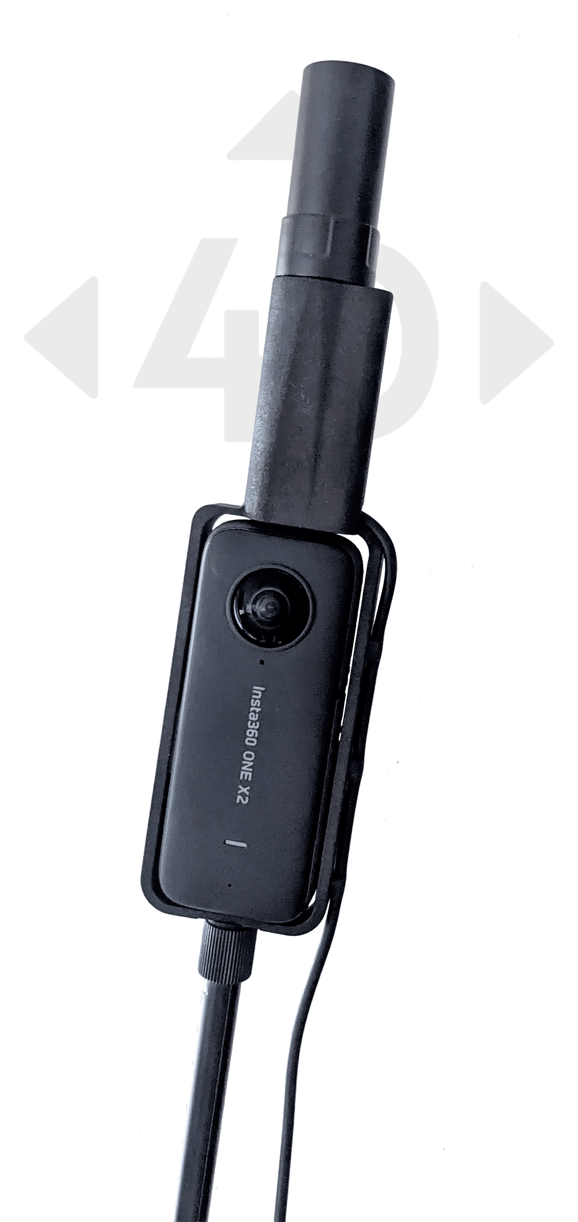
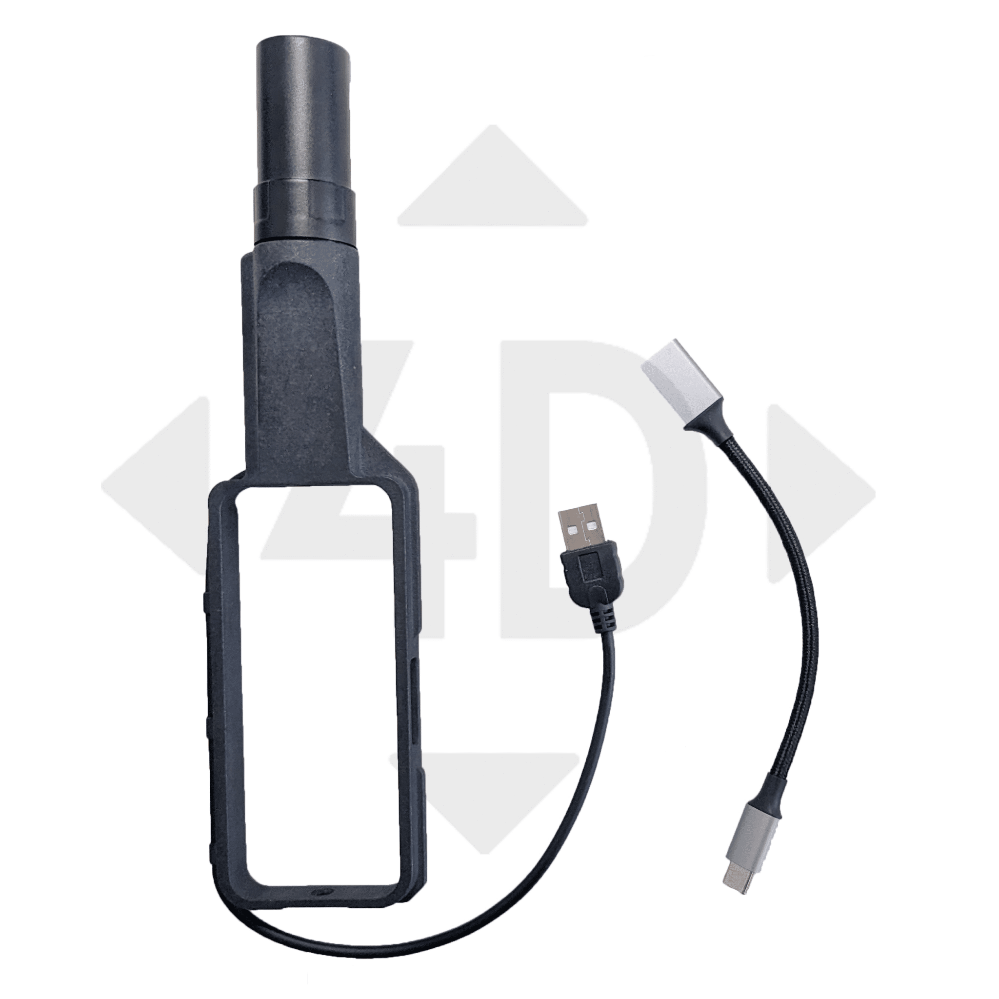
GNSS-RTK add-on
for your 360° Spherical Camera
“Transform the way you capture and document your surroundings with our highly precise GNSS RTK information for your 360° camera.
With centimeter accuracy, you can geotag your spherical images and use this data to derive 3D models, pointclouds and orthophotos with ease through Photogrammetry software.
The valuable information captured is perfect for documenting infrastructure, as the accurate position is provided. With our all-inclusive package, all you need is your camera to start enhancing your work. So, let’s revolutionize your documentation process and achieve your goals with greater ease and efficiency!”
Compatible cameras
- Insta 360 ONE x4 / x5
- Insta 360 RS 1inch
- DJI Osmo 360
- Ricoh Theta Z1
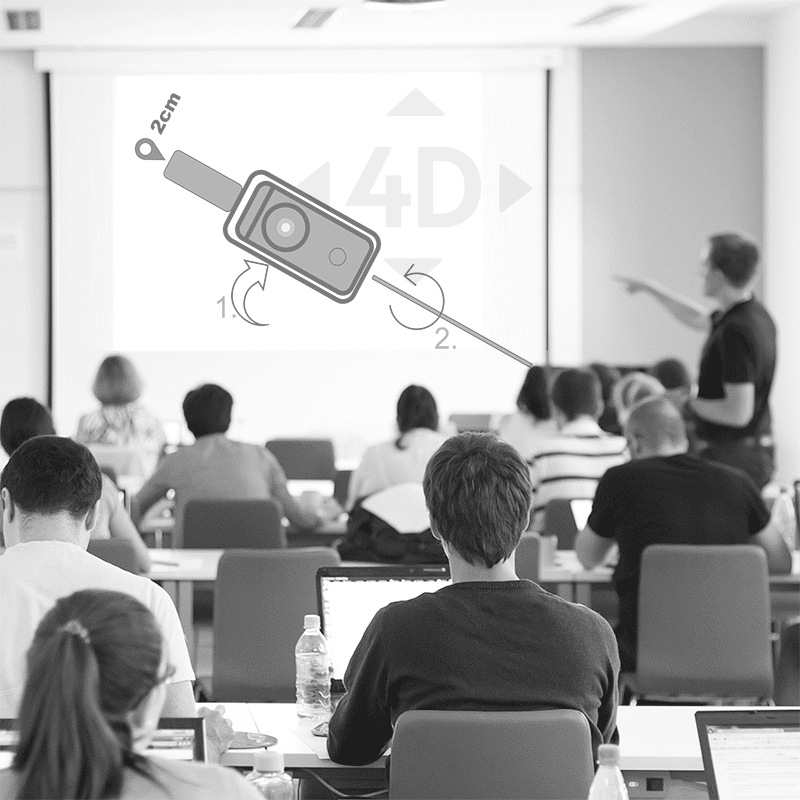
Watch and get inspired
...for desicion makers
... for technicians
Technical Specifications
GNSS
- GPS, GLONASS, Beidou, Galileo
- Multiband: L1, L2, E5b
- Channels: up to 184
- ublox ZED F9P chipset
Accuracy
- RTK 0.01 m + 1 ppm CEP
- anti-jamming and anti-spoofing
- Depends on atmosphere, baseline length, satellite visibility, etc.
- RTK requires a subscription at local provider or own Ntrip caster
Connection to Smartphone
- USB cable
- NTRIP + Logging App for Android 12+ included
Environment
- Temperature -10°C to +45 °C
- Not waterproofed
- Please protect it from moisture and wetness
Pricing
360RTK add-on
- RTK L1/L2/e5 GNSS add-on device
- USB cable to connect to smartphone (USB-C)
- Android App to connect to NTRIP and logging
- training material
+ Training
- 4 h online Training & Support
- Data capture strategies
- Workflow optimization
- Photogrammetric processing
Manuals & other documents
Manual for 360RTK add-on hardware: LINK – go to page
Using REDtoolbox to geotag the photos: LINK – go to page
How to process 360° spherical photos in Agisoft Metashape: LINK – go to page
FAQs
- What photogrammetry software to I need to create 3D model from spherical images?
- There are Agisoft Metashape and Pix4D mapper available, which support these types of camera
- Do I have to take photos or is video also possible?
- We suggest making videos for the 3D model, and photos as "GCPs" for georeferencing. From our experience, this results in best output
- Can I get a training from REDcatch?
- Happy to do so. We provide trainings on record strategies in die field, photogrammetry and GIS. Either at your office, here in Fulpmes or Online. Contact us
- Is the device suited for a vehicle based mapping, e.g. on a car?
- Yes and no. Weather the camera, nor the RTK are designed for this usecase. Both are made for slow speeds like walking/cycling. We don't suggest but we know users doing so with great results.
- Are the results as good as using a DSLR camera?
- No. Due to lens distortion, image resolution, merging two half spherical lenses to one images, etc .... the photogrammetric results won't be as good. But they are "better in another way" due to 360° perspectives
- Why don't you influence directly into camera via Bluetooth or similar?
- Koordinates in cameras EXIF data are only 6 digits precise. You wont get centimetre accuracy as you need 7+ digits. example: 47.12345678°
- Is the camera included?
- No, please get one from your local electronic shop
- Can you do surveys?
- Yes, but it's more related to "mapping" as due to low resolution images the results will be not that detailed as with a terrestrial lidar scanner.
Getting started
RTK360 camera add-on Industries
Natural Hazards
Mapping Cemetery
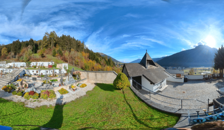
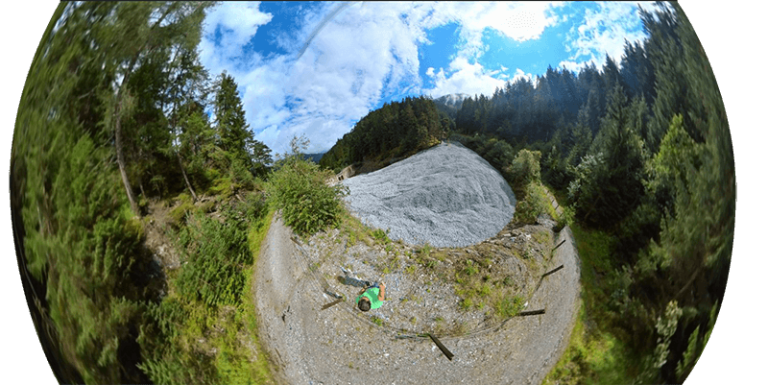
An example 360° spherical image from the cemetery of Fulpmes/Stubaital.
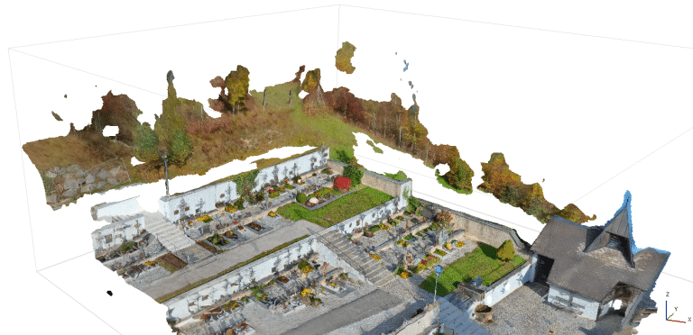
The resulting 3d model and orthomosaic is perfect for grave inventory/catastre and deriving escape plans.
Road Inventory mapping I
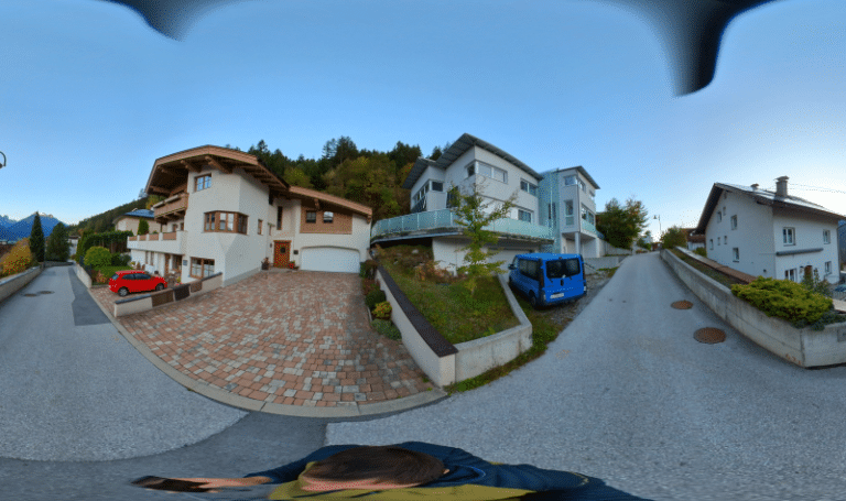
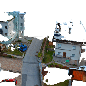
Road Inventory mapping II
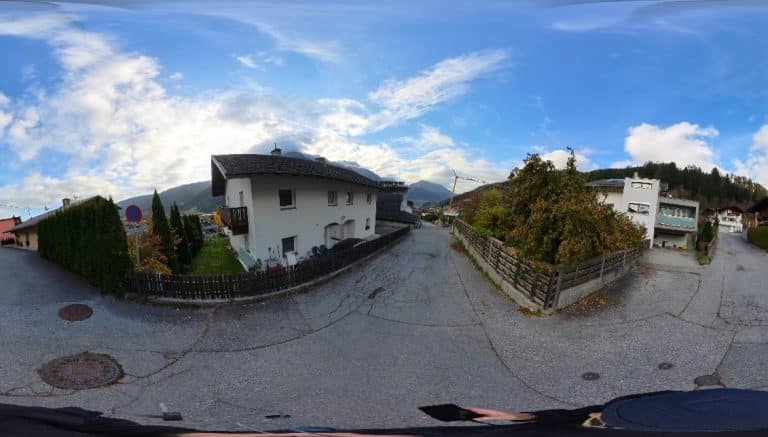
Walking along the road and taking images every 2-3 meters.
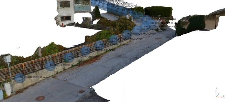
The resulting 3D is true to scale and you can even derive an Orthophotomosaic from this terrestrial survey.
Terrestrial survey of a playground
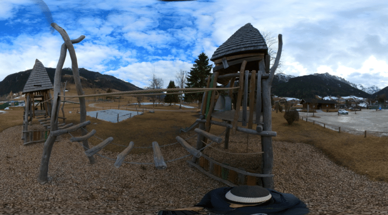
An example spherical image taken with Insta 360 one X3, geotagged at cm-accuracy using 360RTK camera add-on
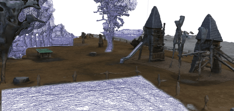
The resulting 3d model of the playground was processed from 202 images. Directly georeferenced, no GCPs needed. The image is hybrid showing wire-frame and textured parts.
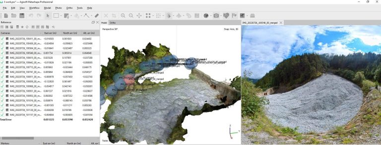
Calculate volume in a no fly zone
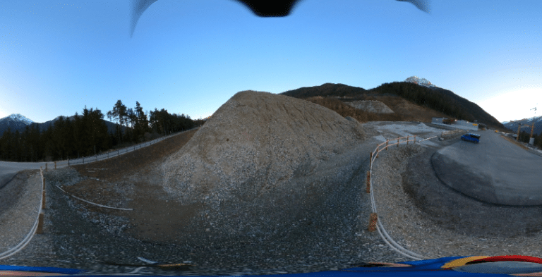
A photogrammetric survey for volume calculation in a drone’s no fly zone. This is an example equirectangular image.
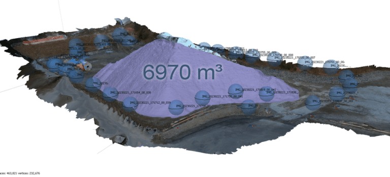
With only a few spherical images, the stockpile and the surrounding area can be surveyed and the volume determined.