
Xmas opening hours
Along with greetings and lots of thanks to our customers, we like to inform that until January 4th we spend some time with our families and friends. Support and email correspondence will be done, but delays will occure. Thank you for your understandig.
REDcatch GmbH - Pointcloud Engineering
Innovative Technologies and Services for 3D Surveying
REDcatch develops, produces and integrates Hard- and Software products for drone- and terrestrial 3d modelling.
For more than 8 years we have been developing cutting edge technological products, services, software and Apps to enable easy 3D scanning of objects. Our customers are within a variety of industries, including surveyor, infrastructure, construction, architecture, archaeology, engineering and many more.
-
GNSS RTK and PPK hardware
for digital cameras and Android phones
-
3D Photogrammetry
Training, Service, Software, Expirience
-
Apps and Tools
REDtoolbox, RTKcamera App, QGIS Volume calculation Plugin
-
Support and Training
the best team with lots of knowledge to share with you!

3D ImageVector
A centimetre accurate RTK/PPK GNSS & IMU for your high end camera
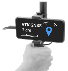
Smartphone RTK
Designed for RTK GNSS based 3D Photogrammetry, this Android add-on is perfect for direct georeferencing.
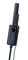
RTK360
GNSS RTK add-on for your spherical 360° camera: Compatible to
- Insta360TM X2/X3
- GoPro MaxTM
- Ricoh Z1TM
REDtoolbox
Desktop Software for GNSS Postprocessing, Geotagging, RTK-Shift images.
Compatible to various drones and devices from DJI(TM), Autel(TM), Yuneec(TM), Emlid(TM), Speptentrio(TM), uBlox(TM), etc.

RTK camera (App)
The Android App to connect to NTRIP and take georeferenced, full resolution images. Automatic triggering / feature based triggering.

Training & Support
Online or in person, we provide professional training on:
- Our hardware devices
- Terrestrial photogrammetry capture strategies
- Photogrammetry software
(Agisoft Metashape, Reality Capture)
- Workflow and Data exchange optimization
Contact us to enhance your skills and improve process stability and output quality

